June 2019 – Top of the World Highway – Delta Junction – Chena Hot Springs – Alaska Part 5
On Tuesday June 25th we planned to leave Dawson City, YT. We had actually scoped out the ferry a few days earlier to make sure we could maneuver over with no issues. We realized after watching several trips loaded, with a diverse set of rigs, that detaching the Mini and heading over separated would be a very wise decision. The ramp was too steep for us to avoid dragging or possibly damaging the toad or the rig. Even detached, the ramp was a challenge. We realized arriving first thing in the morning was important to avoid considerable delays and long lines waiting for our turn to board and cross.

The George Black Ferry over the Yukon River
Arriving early and detached proved to be a great decision; we were across the Yukon River by 8:30am and already ascending to the famous “Top of the World Highway”. The “Top of the World Highway” connects Klondike Loop from Dawson City and the Taylor Highway linking Chicken, Eagle and the Alaska Highway. The 65-mile Top of the World Highway is a winding, narrow road at points, with extremely soft shoulders, frequent surface breaks, potholes, and unbelievable washboard areas. This drive isn’t for the faint of heart and I’m not sure who is better off , the driver or the passenger. Joanne spent much of the drive on the edge of her seat, in fear, as home was on the roads edge for hours. When on-coming traffic approaches it is even more precarious…The drive takes about 3-4 hours to arrive at Chicken, AK.

Top of the World…(Highest Point)

Top of the World…(Highest Point)

Top of the World…(Highest Point)
With no guardrails and steep cliff drops, “Top of the World” is a challenging drive. Our Class A coach and Mini tow car were sand blasted and stoned for nearly all but 11 miles of this road. The washboard nearly shook us apart at times and it was like driving through an earthquake for hours!
One of the interesting moments was when a mother caribou and it’s off-spring jumped out of the adjacent woods and proceeded to lead us down the road for nearly a mile…
A little video from “Top of the World”:
Arriving at a look-out spot, just above the Border crossing between the Yukon, Canada into Alaska, USA we decided to take a break for a few minutes. Walking along a path, by this stop, we discovered a herd of hundreds of Caribou grazing just over the hill. This region is home to the Fortymile Caribou herd. The 360 views from this place were so amazing we decided to just boon-dock for the night here. This spot is the highest point on highway (elev. 1,376 m/4,515 ft).
We met several other travelers while parked here that were equally amazed by the views, though we were the only rig that had decided to stay the night. An interesting moment happened after dinner about 11:00pm, we heard some noise outside the RV. We opened the windows and door and found another large herd of Caribou walking up the road and adjacent to our boon-docking spot. I don’t think I’ve ever seen this many Caribou in one spot or this big! Great photo opportunity…

Here they come …Our Caribou visiting Herd…

Our Caribou visiting Herd…
The next day we headed down to the border crossing (the U.S.-Canada Border – U.S. Poker Creek & Canada Little Gold Creek Customs). The joint operations opened in 2001-2002. The road is gated after hours, open only during summer 9 a.m. to 9 p.m., Pacific on the Canadian side and 8 a.m. to 8 p.m on the U.S. side. The Poker Creek Border Crossing is North America’s most northern international border crossing.

Approaching the Border…
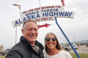
We have been traveling for nearly 2 months with just a few stops in the Southern Alaska towns of Hyder and Skagway, though today we were actually crossing into Alaska for the next 6 weeks of travel and this is why we embarked on this trip. We were giddy with excitement this day.

Poker Creek, Alaska
Crossing the border was uneventful (like all of our other crossings to-date) and we were quickly driving towards the famous Chicken, AK. The Boundary Spur Road from the U.S./Canada Border to Jack Wade Junction is newly paved. Here you connect to the Taylor Highway, which travels West to Chicken, or North to Eagle, AK. The 30 miles from Jack Wade Junction to Chicken is gravel and steep. I would suggest planning plenty of time to reach Chicken. Chicken is at mile 66 of the Taylor Highway. If you blink, you’ll miss the tourist spot of Chicken. In addition to gas, chachki souvenirs, and the classic pic by the giant chicken, you will also find the find the home of the Pedro Gold Dredge and Tisha’s Schoolhouse…

Chicken, Alaska

More of Chicken…
Departing Chicken after getting some very expensive gas for the RV and a well deserved, incredible, chocolate chip cookie – we continued on the Taylor Highway another 66 miles arriving at Tetlin Juction and the Alaska Highway. We continued North to Delta Junction. Delta Junction is the official end of the Alaska Highway. From here, the Richardson Highway continues North towards Fairbanks. We had certainly put in some miles over the last few days and decided to start looking for a good boon-docking place to re-group for a few days before getting to Fairbanks.

The Taylor Highway…
Driving thorough Delta Junction we stopped for a few provisions at the grocery store and wine before continuing on our quest for the perfect spot to spend a few nights. We drove through Delta State Recreation Site, Quartz Lake Recreation Area, and a few other places, still not finding the right spot. A little further North and we found a turn-off that was hidden from the road on a beautiful lake. The spot was very private and easily accessible. It was exactly what we had hoped to find. There was good connectivity, a lake/river view, and several moose that visited with newborns over the next few days. We also had sufficient solar being collected. We felt fortunate to find this gem our first night over the border!
A few pics of this special boon-docking spot:

Our Boon-docking spot just North of Delta Junction…

A few moose visits here…
Having recharged for several days at this spot, we got back on the Richardson Highway for Fairbanks. Arriving at Fairbanks we were able to re-provision with our normal Super Walmart visit and gas at Costco. Note: Costco in Canada doesn’t take Visa though back in the US we were fine again.
From the moment we got out of the RV in Fairbanks it was obvious that the famous summer forest fires of Alaska had arrived. Forest fires in alaska are allowed to burn in some-what controlled burns, which is a natural way to control forestation. We discovered that Fairbanks, AK is in the central Tanana Valley, straddling the Chena River. The smoke settles in this area and can, at times, make breathing and visibility difficult. We discovered many people walking and working with masks on their faces. Fairbanks is the largest city in the Interior region of Alaska. 2016 estimates put the population of the city proper at 32,751, and the population of the Fairbanks North Star Borough at 97,121. Next to Anchorage, it is the second largest city in Alaska. Fairbanks is the coldest large city in the U.S with normal monthly mean temperatures range from −7.9 °F (−22.2 °C) in January, to 62.5 °F (16.9 °C) in July. Today , it was unseasonably warm with a mid-day temp in the 90’s. (Hard to believe…)
Knowing we were going to spend a few days visiting and exploring Fairbanks, today we were just passing through as the plan was to continue North to “Chena Hot Springs…” “Chena Hot Springs Resort” is located just 60 miles North of Fairbanks and is at the end of the road! We had to pass many parks and recreation areas on the way up and though we considered camping at some, we opted to drive all the way to Chena and camp at the resort. They have several sites (dry-camping) that could accommodate our rig for $20.00 a night which we expected would work well and allow us to enjoy the resort after setting up, not having to drive at all while visiting here. (Turned out to be a great decision!)

Chena Hot Springs…

Chena Hot Springs…

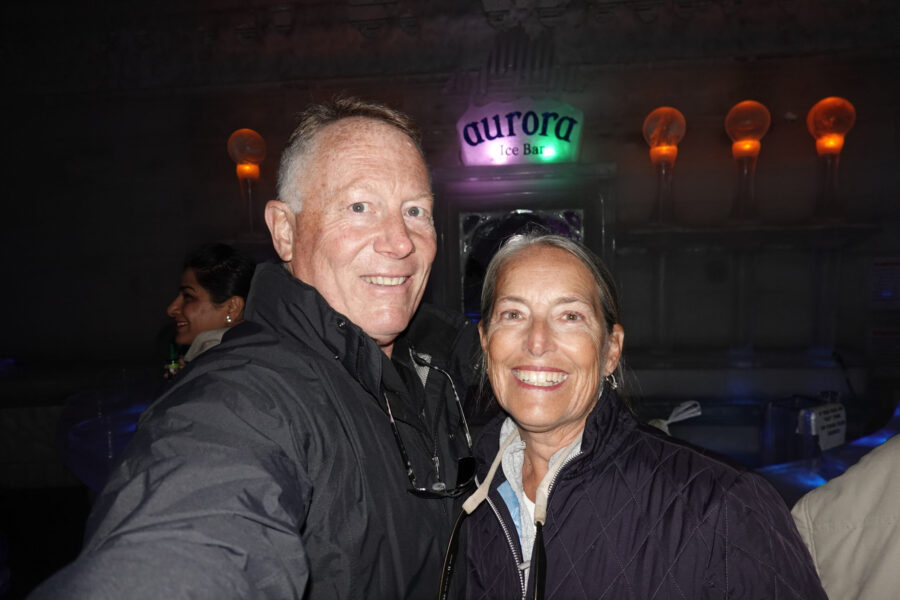
Aurora Ice Museum/Bar…

Joanne enjoying her Appletini…

The Chena Geo-thermal tour…

The Chena Hot Springs Resort Restaurant…

The Hot Springs… (Very Toasty)
Chena Hot Springs is a destination area for tourists. Apparently, it serves as a great spot in the colder months to witness the “Northern Lights” which unfortunately we were too early to see. In spite of missing the lights, we definitely enjoyed the other tourist things to do here including: The Hot Springs (Super!), the famous Aurora Ice Museum/Bar (Great Appletini…) a very good restaurant on site, tours of the dog sled kennel area, the geo thermal building, the university garden/vegetable greenhouses, and several nice hiking trails. Aside from the smoke from the forest fires, (where we were concerned we might be stranded on the wrong side of or might have to be evacuated for), it was a terrific couple of relaxing days…
Between our boondocking spot and our visit to Chena Hot Springs we were on a great roll our first few days in the 49th state and this continued “Revolutionary Journey”…

